Tell el-Retaba (Egypt)
The fourth season of the Polish-Slovak Archaeological Mission in Tell el-Retaba
Dates: 14 September – 28 October 2010
Team:
Dr. Sławomir Rzepka, director, archaeologist (University of Warsaw)
Dr. Jozef Hudec, co-director, egyptologist (Aigyptos Fundation)
archaeologists: Mária Briliaková (Comenius University in Bratislava), Veronika Dubcová (University of Vienna), Andrea Ďurianová (University of Trnava), Karolina Górka (University of Warsaw), Sylwia Gromadzka (University of Warsaw), Łukasz Jarmużek (University of Warsaw), Viktória Tittonová, (University of Trnava)
students of archaeology: Bartosz Adamski, Cezary Baka, Malwina Piorun (Institute of Archaeology, University of Warsaw)
Miron Bogacki, photographer (University of Warsaw)
Claire Malleson, archaeobotanist (University of Liverpool)
Wiesław Małkowski, geophysicist (University of Warsaw)
Dr. Anna Wodzińska, ceramologist (University of Warsaw)
Lubica Zelenková, egyptologist (University of Vienna)
Amr Mohamed Galal, Nasrallah el-Kilany and Rizq Diab Ghadiry Hassan, SCA inspectors, archaeologists
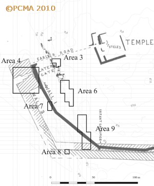
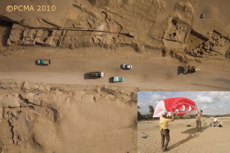
The mission’s fourth season was again constrained by the demands of salvage operations in the area where the second line of a modern asphalt road crossing the site is planned. Excavations were conducted in areas 4, 7 and 8 on the western side of the macadam road and areas 3, 6 and 9 east of the road [Fig. 1]. Several sessions of aerial photography were conducted on the site, using a kite-lifted camera. Three flowform kites of various sizes were used, under which a remotely operated Canon 5d camera was hung [Fig. 2]. The geophysical prospection was also continued, this season by W. Małkowski.
Areas west of the asphalt road (Jozef Hudec)
Area 4
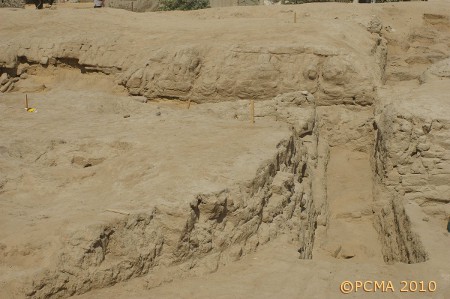
The trench was located in the passage between two massive mud-brick towers of the western gate (migdol), dated to the late Ramesside period. An old cut backfilled with sand was associated with E. Naville’s excavations of the late 19th century [Fig. 3, bottom left]. Presently, the southern and part of the eastern face of the north tower were cleaned and the tower’s east–west dimensions were determined. Despite damages caused by illicit digging sometime in the past few decades, it was also possible to trace a passage situated between the older defence wall (Petrie’s “wall 1”) and the eastern flank of the south tower. [Fig. 3, top].
Cleaning of the surface of the south tower revealed the extent of modern damages, caused either by sebakheen and/or by weather conditions. The passage between the gates, of which the narrowest point was at the eastern end, broadened toward the west. Masonry found in the gate passage indicates that the entrance was sealed in a later phase(s) [Fig. 3, bottom right].
Areas 7 and 8
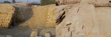
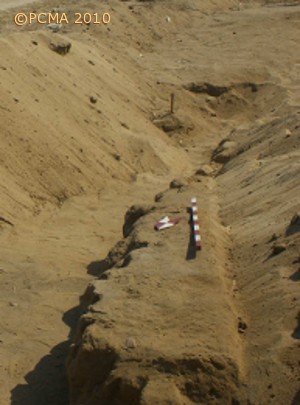
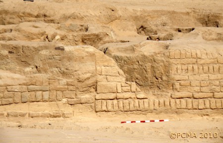
The two trenches were located in spots where relics of Petrie´s walls 1 [Fig. 4] and 3 could be traced. In both cases, the damages by sebakheen digging and the modern macadam road proved to be extensive.
Areas east of the macadam road (Sławomir Rzepka)
Area 3
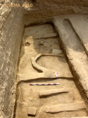
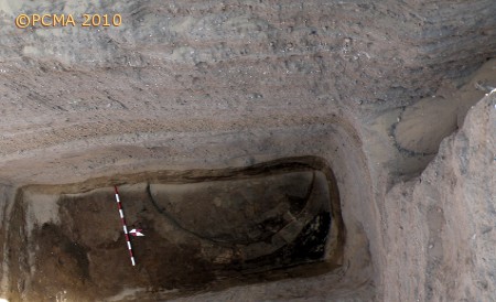
In 2009 an ancient road was discovered leading from the western gate (migdol) toward the middle of the fortress. The road was in use from the late New Kingdom until the Third Intermediate Period. In 2010 excavations of this road were continued, proceeding eastward. Underneath the road a massive wall was discovered, running N-S, parallel to a wall running approximately 5 m to the west, uncovered already in 2009. These walls seem to belong to a structure resembling the large barracks found in area 9 (cf. below) and can be dated to the same period (early Nineteenth Dynasty). The small structure with very thin walls which was cleared underneath this wall can be dated to the Eighteenth Dynasty [Fig. 5]. Still deeper, approximately 6 m under the present surface of the tell, a round structure was discovered, possibly a granary of early Eighteenth Dynasty date [Fig. 6]. The clean, yellow sand underneath this structure could already be gezirah sand.
Area 6
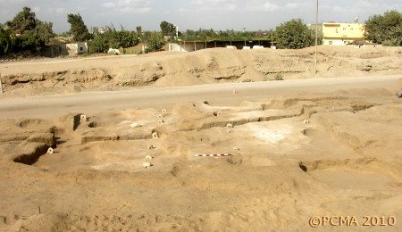
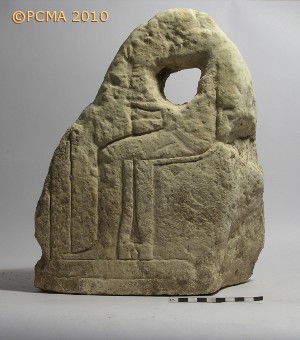
Instead of a road suggested by the geophysical survey carried out in 2008, a large complex was discovered and identified as a place for keeping animals. The largest unit was a stable with two rows of tethering stones [Fig. 7]. Altogether 16 tethering stones were found, all made of limestone. Reliefs were noted on four of the stone fragments. In one case, the relief depicted a seated god [Fig. 8], the other examples were fragments of monumental inscriptions containing the royal protocol. It seems that blocks from a destroyed temple, possibly that of Atum, had been salvaged to produce the tethering stones (Petrie had discovered some blocks from this temple during his excavations in 1905). It is known that Ramesses II built this temple, which was probably enlarged by Ramesses III. As the stable can be dated to the Third Intermediate Period, the New Kingdom temple must have been destroyed by this time.
Area 9
Previous seasons of fieldwork have shown that Petrie’s “wall 1” was actually a two-phased foundation of New Kingdom date. This year it was discovered that the wall core was constructed during the Eighteenth Dynasty, the dating being confirmed by some pottery fragments recovered from an ashy layer underneath the wall. The wall was reinforced, reaching its final width of ca. 5 m, in the times of Ramesses II.
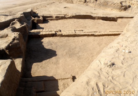
A pavement on the outside of the wall [Fig. 9] was made of a single layer of mud bricks covered with clay mortar. The layer of potsherds and animal bones covering the pavement in a thin layer apparently represents refuse thrown down from the top of the defence wall.
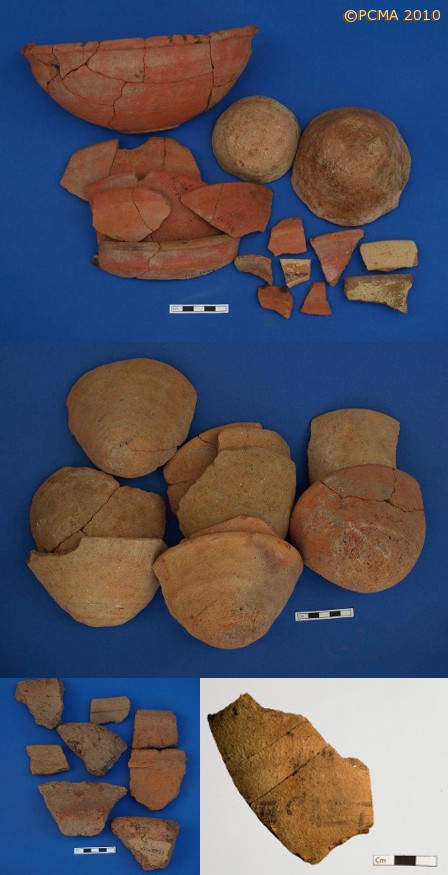
Two long barracks, which can be dated to the reign of Ramesses II, abutted the inner face of “wall 1” and more units of this kind can be expected to the south [Fig. 10]. They were 3.50 m wide and at least 13 m long (the full length could not be excavated this year). The domestic function of the excavated structures is proved by such finds as an oven and big quern in one of the units and remains of a reed mat in the other, as well as by the domestic pottery found there in large quantities. Finds of note include a hieratic label found on a wine amphora [Fig. 11, bottom right] and a large number of scrapers made of reused pottery sherds.
Pottery assemblage
The ceramologist Anna Wodzińska recorded 4016 diagnostic fragments of pottery from 116 stratigraphic units representing four phases of site occupation.
From the deepest excavated trench came pottery from the early Eighteenth Dynasty, most probably from the time of Tuthmosis III (147 diagnostic fragments). Red slipped bowls, some with black-painted rims constituted gross of the assemblage [Fig. 11, top]. A number of carinated bowls with low ring bases were decorated with black painted strokes placed on top of the rim.
Nineteenth Dynasty material included 369 diagnostic fragments, mostly red-slipped bowls of various sizes, but also some handles and bases of wine amphorae. A number of sherds represented objects secondarily made of vessel body and rim fragments.
The Third Intermediate Period was represented by the largest quantity of ceramic vessels (2601 diagnostic fragments). An extremely frequent form this season was a small conical cup probably for drinking [Fig. 11, center]. Other pots were also present, large bowls with flaring rims and cooking pots with almost cylindrical necks, but their number was clearly smaller.
The Late Period layers (386 fragments and 282 fragments from mixed layers containing also Third Intermediate Period material) yielded sherds of large storage jars, coarse basins and flat bread trays [Fig. 11, bottom].
[Text: J. Hudec, S. Rzepka, A. Wodzińska]
