Dongola 2008
Excavations of the Citadel in Dongola have already brought to light a building identified as a palace of the Dongolan kings (B.I) and a cruciform commemorative structure which stood right next to the palace entrance from the south (B.III). Three other structures identified in the near vicinity of the palace entrance courtyard (B.V., B.VIII and B.VIII) have yet to be examined more extensively in order to determine their function. These buildings were all functional from the first half of the 7th through the 10th century., that is, from the formative stages of the Makurian kingdom to its heyday. One of the tasks of the present season, which lasted from 28 January to 7 March 2008 and was directed by Włodzimierz Godlewski, was to explore these structures.
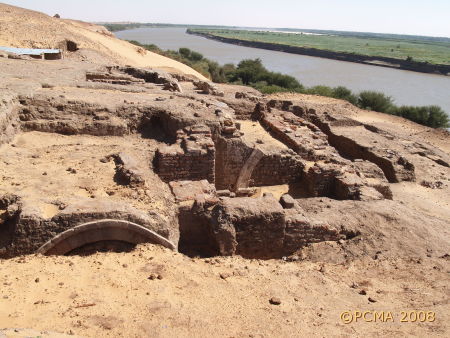
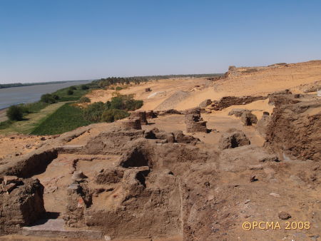
The palace B.I is the biggest building in the complex discovered so far on site SWN as this sector on the Citadel is called. The best estimates places its area at more than 1000 square meters. The southern entrance, which was used by those arriving from the river harbor, gave access directly to the residential upper floor. The most recent work uncovered the entrance from the north. It was a broad stone arcade that opened onto the ground floor and through another stone gateway into a long corridor with stores on either side, occupying the western end of the palace and adjoining the riverside citadel fortifications.
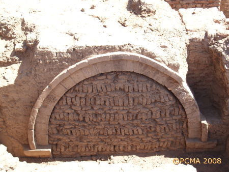
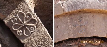
The outer northern entrance rose to a height of 3.50 m, the width being 2.50 m. The name of the founder, King Ioannes, appeared in a monogram on the keystone. Ioannes is the first Dongolan ruler known today by name and his rule fell in the first half of the 7th century. He is assumed to have preceded King Qalidurut known from Arabic sources, the ruler who defended the town heroically against an Arab raid in AD 651.
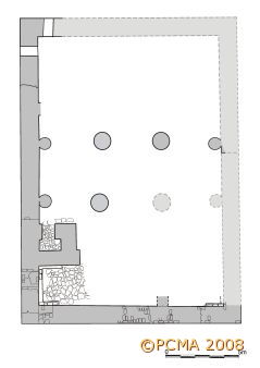
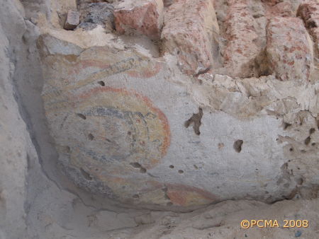
Building B.V lies to the south of the small commemorative monument (B.III) uncovered in 2003. It was erected on a central plan, apparently in the 9th century. With sides measuring 21 by 15 m it was a medium-size structure, obviously domed, the cupola rising from four round pillars. The walls were of baked brick, finely plastered and painted. In the eastern end, the walls survive to a height of 3.80 m, while in the western end they appear to have been removed down to the pavement floor (in the early 20th century apparently). At this point (the structure has yet to be cleared of the fill) all that can be said with certainty that it was an official building, most likely sacral in function, and must have been connected with the palatial complex on the citadel.
Exploration of the terrain to the north and south of the palace complex revealed further structures: B.VII built onto the façade of the palace B.I and B.VIII adjoining the façade of B.V. Both were raised of mud brick and the walls are estimated to survive to a height of at least 3 m.
The other site, which started to be explored in the northwestern corner of the Citadel in the previous season, is C.1. A large mud-brick building (B.VI) uncovered here (the full size is not yet known) is situated at the edge of a rocky cliff, rising steeply from the river at this point. So far, a big hall has been explored, its ceiling supported of six columns constructed of brick, and a number of chambers of different size in the southwestern part. While it was certainly in use in the 11th-12th century, there is no doubt that its beginnings fall at a much earlier date.
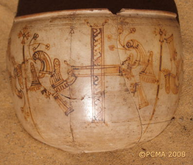
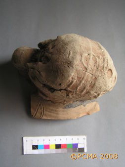
Meriting attention among the registered objects from the citadel excavations is a vessel painted with a frieze of birds adoring a cross, dated to the 9th century. Two locally-made amphorae still had stamped mud stoppers sealing their necks. More than a hundred such amphora stoppers have been recovered from the palace so far, but always in connection with amphorae imported from Egypt. The present find proves that the same practice of sealing the contents of wine amphorae, known from Egypt, was common in Makuria.
Excavations in Building B.VI (site C.1) yielded a small bronze coin, significant because it is a Byzantine issue of the 6th century, the first such find ever to be made in Dongola. It appears to have been used as jewelry. From the same context comes a bronze cross (still before cleaning) which appears to have had plastically shaped arms.
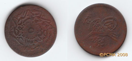
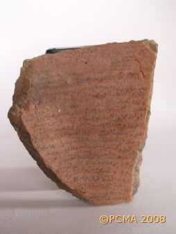
The lower city south of the citadel, located on the rocky river bank, dates to the latest period in the existence of Dongola, the 19th and early 20th century (although earlier occupation in this area is very likely). These remains have been documented now, including the surviving east town wall defending it from the east and south. More attention was extended to a structure preserved at ground level and apparently older than the rest of the architecture (S.40). Its clearing yielded china tableware and two bronze coins of the Egyptian khedive Abbas Hilmi (1848-1854). Also found was a two-sided ostracon in Arabic, most probably of 19th century date, containing a list of deeds made out to more than a dozen persons, presumably residents of Dongola.
[W.G.]
