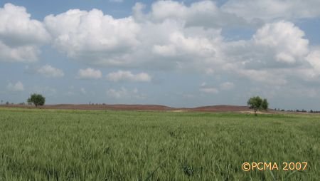
Tell el-Balamun (Egypt)
Tell el-Balamun in the northeastern Nile Delta has been excavated by a British Museum expedition directed by Jeffrey A. Spencer since 1991. In the course of the years, the following main features have been identified by survey and targeted excavations: the Amun’s Temple’s two enclosure walls of the Twenty-sixth and Thirtieth Dynasties, the main temple of Amun, subsidiary temples of Nectanebo I and Psamtik I, the Fort and its annex, and some Ptolemaic houses. However, the extent of the Amun Temple enclosure (420 by 450 m) precluded any possibility of complete excavation. At this point, Tomasz Herbich representing the Polish Centre of Mediterranean Archaeology came in as an external partner, his task being to carry out a geophysical survey of the area, using magnetic mapping as the technology.
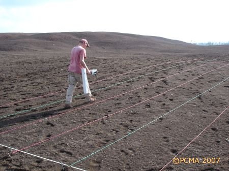
To put it simply, “magnetic surveying of archaeological sites relies on the ability to measure the intensity of small magnetic fields associated with buried remains. Archaeological objects can act like small magnets which disturb the Earth’s magnetic field. By recording these disturbances (with the use of a magnetometer), a detailed plan of a site can be obtained.” (EA 29, 2006,18). In this case, Tomasz Herbich and his assistant Dawid Święch used Geoscan Research FM-36 gradiometers to record measurements every 0.25m along lines spaced at 0.50 m, applying the parallel mode, which means that the operator walks in one direction only. The measured units were 20 by 10 m. In the first season, in April 2005, the survey covered 6.3 ha, in 2006 another 6.9 ha. The walking involved is only for the hardy – during the 10 days of scanning in 2006 the geophysicist walked 300 km between them.
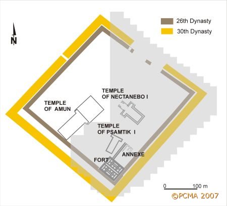
A look at the schematic plan of the temple area with enclosure walls shows how much of the site has been covered by now: the southern part of the great temple enclosure in 2005 and the northeastern part in 2006. The survey is planned to be completed in 2007. As the prospection includes areas where monuments had already been located and excavated, the results, presented as magnetic maps, confirm their position, showing more detail of known monuments. More importantly, they reveals the presence of previously unsuspected buildings, which barring accidental discoveries would probably have escaped attention in the course of conventional survey and digging. This is the case, for example, of the great temple enclosure walls which the survey has shown to be standing on top of clearly older structures, probably of the Saite period. Many of these structures possess substantial cellular foundations and they were clearly official structures.
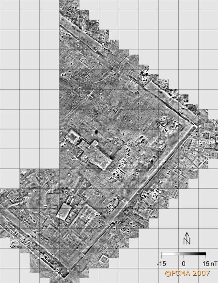
Despite the erosion of the enclosure walls, which run parallel to one another a mere few meters apart, it has been possible to trace their course, as well as the pan-bedding and associated block construction of both walls. The inner wall, of Twenty-Sixth Dynasty date, is better preserved, although the most distinctive feature on the magnetic map is the space between the walls, characterized by higher values of intensity of the magnetic field due to the presence of ashes, burnt soil etc.
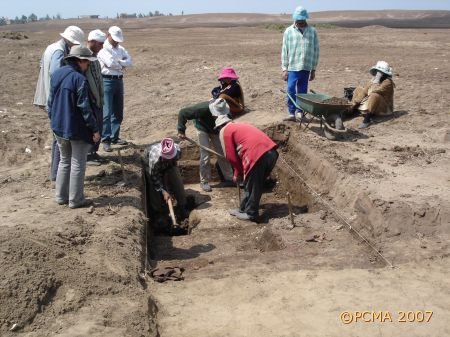
A gate was identified on the scan, located in the southeastern side of the Twenty-Sixth Dynasty enclosure, approximately 180m from the south corner. Excavations were undertaken in 2006, revealing the brickwork that had closed the opening of the gate. The bricks had been laid over fill. The original sand-bed foundation for the stone masonry of the gate, but not the stones themselves, was discovered below that. The jambs of the gate were 6.9m apart.
Other structures verified by excavation in 2006 included an earlier temple, the outline of which had been identified on the scan just west of the small temple of Psamtik I. Test trenches in 2005 had revealed a foundation trench, quite evident from it having been refilled with mixed debris and mud, and a boundary between the sand filling of the naos area and that used in the front part of the temple. These two areas, each characterized by different values of the magnetic field, proved to contain different types of filling. The boundaries of the different features in the ground agreed well with the information provided by the scan. In 2006, testing concentrated on a conspicuous anomaly of high magnetic values located at the front of the pylon, which also appeared to be approached by some kind of avenue. The anomaly turned out to be an older oven cut by the foundation of the temple. The pylon itself was made of mud brick and it was once cased with stone. Broken chips of limestone had been discovered in a trench dug in the area in 1993, but without the advantage of the magnetic plan, there was no way of interpreting the significance of the find. As for the older remains cut by the foundations of Psamtik’s temple, a date in the Third Intermediate Period is likely.
In 2006 the scanning also revealed a 20m square structure immediately in front of the temple of Nectanebo I. The low magnetic values suggested that it must be made of limestone or sandstone, both materials characterized by low magnetic susceptibility. A brief investigation undertaken by the expedition at the end of the season revealed a substantial building of limestone blocks that was obviously earlier than the adjacent temple. One idea is that it is a bark-station of the nearby New Kingdom Temple of Amun, especially considering the hint of a ramp seen on the scan, approaching from the direction of the Amun-temple.
The exceptional overview of the site provided by the mapping program has already helped to target excavations and its role in planning future work on Tell el-Balamun cannot be underestimated.