Berenike (Egypt)
BERENIKE PROJECT
University of Delaware – PCMA expedition
Sub-projects: Serapis Temple Project
Wadi Gemal/Sikait Survey
Digging dates: 2 January – 17 February 2011
Team:
Steven E. Sidebotham, co-director, coin specialist, photographer (University of Delaware)
Iwona Zych, co-director, terracotta lamps, worked wood and small finds studies (PCMA)
Ignacio Crespo de Lineira, marine archaeologist (freelance)
Miranda Haigh, archaeologist (freelance)
Anna Maria Kotarba-Morley, geoarchaeologist (Oxford University PhD candidate), harbor coring project
Dario Nappo, ancient historian/archaeologist (Oxford University, PhD candidate)
Julian Newman, archaeologist (freelance)
Piotr Osypiński, archaeologist, participant of the Wadi Gemal Project (Patrimonium Foundation)
Katia Schorle, archaeologist (Oxford University PhD candidate)
Marek Woźniak, archaeologist (IAE PAN, Warsaw, PhD candidate)
Bartosz Wójcik, archaeologist and photographer (University of Warsaw, Institute of Archaeology, undergraduate student)
Mary Caulfield Sidebotham, archaeology volunteer, video documentation
Beata Dziedzic, volunteer
Specialists:
Dr. Rodney Ast, papyrologist (Institute for the Study of the Ancient World, New York University) *
Sonali Gupta Agarwal, pottery assistant (UCLA, PhD candidate)
Anna Babiarz, registrar and illustrator (University of Warsaw Institute of Archaeology undergraduate student)
Prof. Roger Bagnall, papyrologist (Leon Levy Director and Professor of Ancient History, Institute for the Study of the Ancient World, New York University)*
Mariusz Caban, architectural documentalist (Wrocław University of Technology undergraduate student)
Barbara Czaja-Szewczak, textile specialist (Wilanów Palace-Museum)*
Mariusz Gwiazda, leather documentalist (University of Warsaw, Institute of Archaeology, undergraduate student)*
Marteen Hense, metal specialist, head of the Serapis Temple sub-project
Renata Kucharczyk, glass studies specialist (PCMA)
Dr. Marta Osypińska, archaeozoologist (IAE PAN, Poznań)
Katarzyna Lach, conservator (Jagiellonian University, Kraków, PhD candidate)
Jean-Louis Rivard, architect (10BASE-T Incorporated), Wadi Gemal Project head supervisor
Dawid Święch, geophysicist (freelance)*
Dr. Roberta Tomber, ceramologist (British Museum)*
Dr. Jerzy Trzciński, geologist (University of Warsaw, Faculty of Geology)*
Monika Więch, pottery assistant, responsible for Wadi Gemal Project pottery
Teresa Witkowska, illustrator and photographer (freelance)
* prevented from coming by the Egyptian Revolution of January 25 or other reasons
SCA inspectors:
Hosam Aboud Abd El Hamied (Berenike Project)
Mahmoud Nour Eldin Mohmed (Wadi Gemal Project)
The Berenike Project in the 2011 field season worked according to plan despite certain forced modifications and curtailment of the program caused by the situation following the events of January 25. Among others, the geophysical and geological parts of the program suffered and have been rescheduled to the coming season.
The first of the 2011 program objectives was continued research in the northeastern part of the southern bay of Berenike, expanding on the exploration begun in the previous two seasons in trench BE09-54 and trenches BE10-54S/62/64.
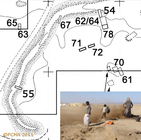
Fieldwork was aimed at establishing relative beach levels and investigating possible harbor-related structures. Trench BE11-78 was a continuation in a southward direction of the earlier trenches, while trenches BE11-71 and BE11-72, each 10 m long and 3 m wide, were located on opposite ends of a feature hypothetically interpreted as the pier ends of a presumed inner harbor in the northeastern part of the bay. The trenches were also aligned lengthwise in order to produce a long profile to be studied as part of the preparations for a geoarchaeological study of the bay. At the close of the season, unable to complete the geological part of the program, we decided on a photographic log of the entire two-times-ten-meters long profile for preliminary analysis by the team’s geologist in office conditions back home.
A geoarchaeological augerhole survey was carried out concurrently with the excavations.
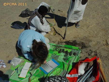
The project is part of a bigger study (prepared as a doctoral dissertation by Berenike team member Anna Maria Kotarba Morley) of port cities and their harbors, aimed at generating scientific datasets to be used in reconstructing the archaeological port landscapes, their infrastructure and capacity, and the logistics of usage of the harbor by exogenous (sailors and traders) and indigenous (local) communities. The primary goal in terms of the Berenike archaeological project was to develop understanding of the port landscape. Two transects were completed, counting a total of 64 auger holes with individual depth ranging from less than 2 m to 5 m. A total of 277 sediment samples was collected for laboratory analysis (particle size, magnetic susceptibility, total carbonate and total organic matter contents). The survey also collected data which upon further comprehensive analysis may contribute to the discussion of relative sea level changes in historic periods on the Red Sea.
In archaeological terms the two trenches BE11-71 and BE11-72 provided a fairly coherent picture of the early to mid second century AD phase in the occupation of the southern bay of Berenike. Fragmentary walls of rough blocks of stone and coral heads without any evident mortar bonding or external plastering, disconnected although possibly following some overall pattern, may have formed part of enclosures.
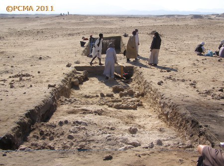
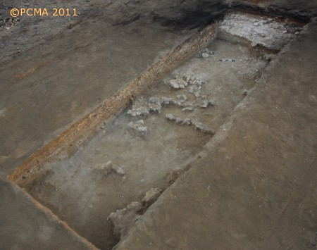
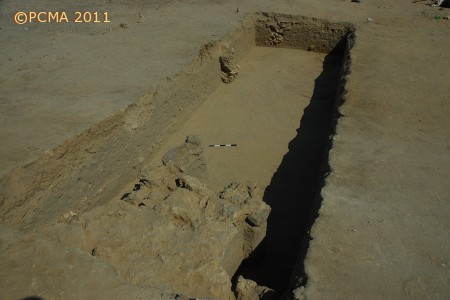
There were no apparent associated floors, although occupational surfaces could be discerned, including a pavement-like feature in trench BE11-72, repaired on at least two separate occasions. These structures either predated slightly or were contemporaneous with the operations, characterized by a thick accumulation of very fine black ashes, taking place just 10 m to 20 m to the north and east of the two trenches. This deposit had been identified already in the combined trenches BE10-54/62/64 and was now explored in a southward extension, in trench BE11-78.
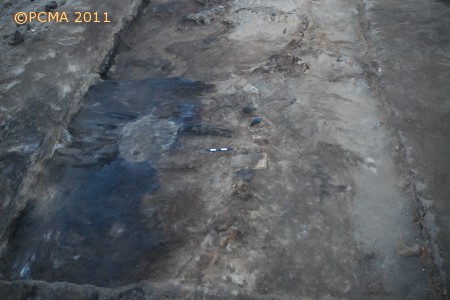
It now seems clear that the ash was deposited against the western slope of a narrow-backed ridge (possibly natural) which descends from the top of the crescent-shaped feature encasing the southern bay in the direction of the presumed island with temples located approximately 90 m to the south and in the center of the purported harbor basin. A late roadway appears to have run along the top of this ridge, possibly connecting the temple with the town in the eastern part of the site. The team is currently exploring an interpretation, based on ethnographic parallels, that the ashes constitute remains of a charcoal-production process.
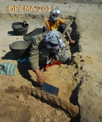
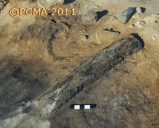
Layers from the 1st century AD and possibly even Augustan times were reached in trench BE11-71. The recorded loci bear close resemblance to the present intertidal beach in the lagoon of Berenike. An intact bowl of Early Roman date (representing a continuation of a common Ptolemaic type) was recovered from the fill.
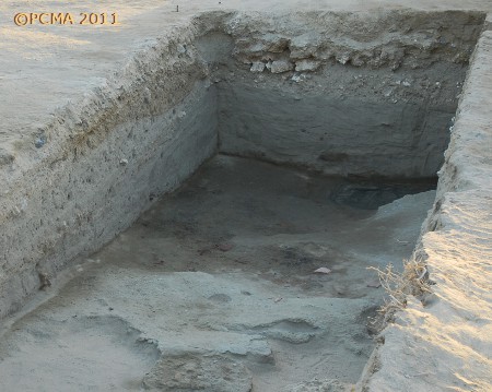
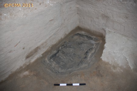
The second objective of this season’s program was to explore further the structures located on the presumed island in the middle of the entrance to the harbor basin where last year a 5th century temple was discovered (BE10-61). Trench BE10-70 from the previous season, where a collapsed wall of gypsum anhydrite blocks was discovered, was expanded to 15 m (E-W) by 8 m (N-S) in order to investigate extensive patches of melted anhydrite spreading in four directions around a mysterious feature filled with sand. The square feature had been apparent on the geomagnetic map of the area (geophysical prospection covered the feature and the area to the north of it; plans for mapping geomagnetically the area to the south of the feature had to be postponed when it turned out that the geophysicists would not be able to reach Berenike this year because of political events) and a sweep of the ground at the close of the previous season had made it quite evident. Following work this year, it has been determined that at least from the late 2nd–3rd century AD and most certainly in the second half of the 4th and in the 5th century AD, when the temple in trench BE10-61 was in operation, the ground around the square feature may have been used as a walking surface.
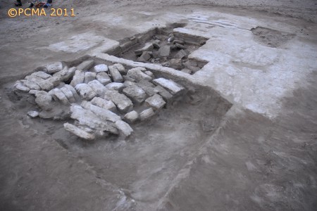
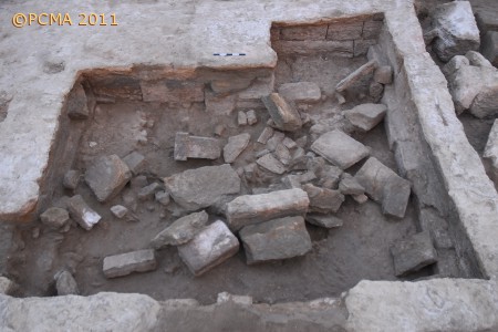
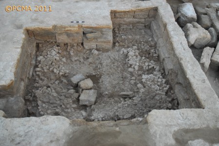
The square feature itself proved to be a structure built of blocks and slabs of gypsum anhydrite, some of them of monolithic proportions (reaching 1.20 m in length). The mutual relations of the walls and their surroundings have yet to be explored. Nonetheless, it appears now that the tumbled wall discovered last year in trench BE10-70 was not part of this structure, but rather of a building that had stood on the spot before the coral head-walls of the later temple were constructed. The square enclosure was 6 m by 6 m big with a wide doorway, later blocked, in the south wall opening onto the lagoon and a narrow doorway fitted with appropriate installations for mounting what was probably a wooden door, at the southern end of the west wall.
Inside, the floor consisted of a bedding of coral heads, about 20–30 cm thick, forming a U-shaped pavement along the eastern, southern and western walls around a free space in the center. A cubical podium, about 1 m high, stood against the north wall, possibly belonging to the original furnishings of this structure. The space to the left of the podium appears to have been blocked off in a later phase, the huge blocks trapping a possible floor slab underneath them. The rest of the floor retained no evidence of paving on top of the coral-head substructure.
The room was found filled with a collapsed structure of some kind, apparently rectangular in shape, and including reused threshold slabs with pivot holes. Architectural tumble was scattered also around it, lying directly on top of the coral-head bedding and in the space free of this substructure in the center. Any additional slab paving, had it existed, must have been removed before the event that caused the tumble. Among the stones there was an inscribed altar of stone, standing on a rectangular base and missing the top (BE11-76/031/001).
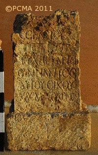
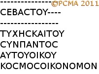
Prof. Roger S. Bagnall and Dr. Rodney Ast believe the missing text records the name and one or more titles of the emperor Domitian (reigned 81-96 AD). The end of the second line and all of the third line were meticulously erased in an act of apparent damnatio memoriae. If, as it now seems likely, the altar stone with a dedication to the emperor Trajan (Berenike 2010, fig. 10) discovered last year, which had been reused in the 5th-century phase of the adjoining temple, was salvaged from the next-door ruins that are presently being excavated, it could be proposed that the square feature was a shrine which experienced its heyday from the times of Domitian (if not earlier) through at least the reign of Trajan (and later presumably), that is, at least from the last quarter of the 1st century AD through the first quarter of the 2nd century AD. It could also be suggested that the dedication to Isis, Tyche and possibly Serapis on the stone discovered last year, actually referred to the gods to which this shrine was dedicated.
Whatever was the cause of the destruction of this shrine, it may have been connected with the evident abandonment of the entire area of the southern bay sometime in the later part of the 2nd century AD. In any event, the building appears to have been plundered thoroughly. The fill of the square structure contained tantalizing evidence of the original furnishings, including the toe of a more than life-size human statue made of bronze and an eye inlay of smooth creamy white stone of matching size. Another eye inlay of ordinary limestone resembles most the kind of eyes that were inlaid on cat mummies of Middle Kingdom date.
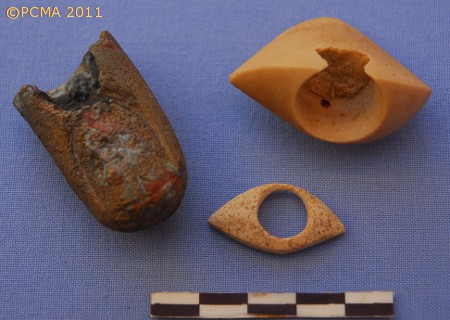
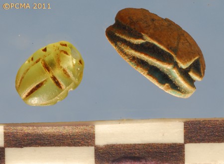
The assemblage also contained a relatively wide range of terracotta oil lamps, including an intact example of the early 2nd century AD, and a gem blank of onyx(?). It should be noted that the fill inside the square structure was evidently disturbed, producing 4th–5th century material that included ostrich eggshell fragments, which had figured so strongly in the assemblage from the nearby 5th century temple last year, appearing in the lower parts. It could mean that the sandy fill inside the structure must have been penetrated repeatedly during the 4th-5th century occupation, presumably in search of any remaining “treasures”.
Third on the program this season was the continued exploration of the Early Roman rubbish dump. One trench (BE11-76) was placed in the immediate neighborhood of the area which has produced an entire archive of Flavian-period ostraca in past years (especially in the 2009 season).
Three other trenches were positioned in other parts of the area to the west of the town proper and north and northwest of the southern bay of Berenike with its presumed harbor: BE11-73 just north of the crescent ridge and to the northwest of the complex of trenches BE09-54 and BE10-54/62/64, BE11-74 some 30 m west of the center of the known Early Roman rubbish dump, and BE11-77, the westernmost of these three trenches, located on a midden of shells and coral, near a wall that could correspond to some of the anomalies featured on the geomagnetic map of the area. This last trench was located the farthest from the town in the east and the nearest to the Ptolemaic industrial district identified in the southwestern part of the site. All were placed in spots where a survey of the ground surface gave promise of rich rubbish layers.
The objective in such a placement of the trenches was to test the extent of the trash-related deposits and to determine whether they all represented the same chronological and typological horizon. This program will be continued in search of answers to questions raised during work this year.
Firstly and not surprisingly, the stratigraphy in all four trenches appeared to follow the same general depositional scheme, the difference in ground level altitudes being due to the lie of the land. Geomorphological studies are needed to confirm whether there was some kind of natural ridge (fossil reef?) that extended northward from the embankment of the bay, aligned north-south, just east of the position of trench BE11-77, explaining the higher ground on which trenches BE11-73 and BE11-74 appear to lie. The ground where the midden explored in trench 77 was located (culturally sterile layers have not been reached this season) seems to have been about a meter lower than the contemporaneous ground surface level in trench BE11-76. The overall thickness of deposits in the eastern and western of the trash trenches was approximately 2 m plus (culturally sterile layers have yet to be reached) compared to the approximately 0.60 m and 0.80 m in trenches, respectively, BE11-74 and BE11-73.
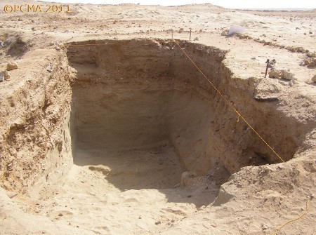
Secondly, the assemblage from trench BE11-77 appears to be the earliest, containing some late Ptolemaic material. On the other hand, the surface and near-surface layers in this trench did not produce any material related to the 3rd century, unlike the more easterly trenches which are closer to the town. The thinness of deposits in trenches BE11-73 and BE11-74 has made precise excavation and dating of successive loci difficult; pending further analysis the assemblages have been attributed to the 1st through 3rd centuries AD. In the fourth and easternmost trench, examination of the material has mounted evidence for a significant nuancing of the lower and upper layers of trash. Loci from the lower phase might be from the first half to mid 1st century AD, possibly Neronian at the latest. The upper phase, which is the ostraca-bearing layer, can be dated to the third quarter and end of the 1st century AD. A smattering of 3rd century pottery and glass vessels was recorded only in the surface loci.
Thirdly, trench BE11-77 produced considerable quantities of charcoal and small-scale industrial waste. Charcoal was abundant also in trench BE11-74, while the other two trenches had very little of this material. The regular trash dump trench (BE11-76), as well as trench BE11-73 can be described as domestic-related waste and refuse from a workshop (wood shavings). Trench BE11-77 seems rather to have contained successive loads of waste from a workshop producing, among others, jewelry and small objects, like boxes with copper-alloy fittings.
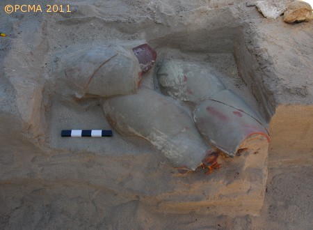
Fourthly, interesting ideas have been posed concerning the beginnings of the trash dump. This part of the site in the end of the 1st century BC seems to have been a sandy ground with some limited architecture (enclosure walls?). One conspicuous sand mound concealed the body of a hound, wrapped in a mat and covered with pieces of a halved amphora (Dressel 5 type, 1st into 2nd century AD). Next to it and on the same level there was the skeleton of a cat.
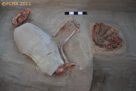
In the same sand loci, a few centimeters above the dog burial, a human skeleton was found. The body had been deposited on its back, hands by the sides, missing the feet, as well as the head and upper part of the torso. Before trash started to be deposited in this spot, the sand was leveled thoroughly, clearly cutting through the mound over the dog and human burials. Was this action intentional, and if so, for what purpose? An exercise ground for the army? An area where transport animals could have been watered and foddered? Enclosures where merchants stored goods in preparation for shipping them out? Whichever was the case (and other hypotheses are surely possible), the empty space quickly started being used as a trash dump for all kinds of organic remains, pottery, baskets, leather straps, ship-related objects, terracotta oil lamps, beads and glass vessels, botanical remains, and sundry other rubbish. Most interesting, however, were the faunal remains: skeletons of cats, dogs, birds, a monkey.
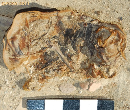
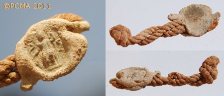
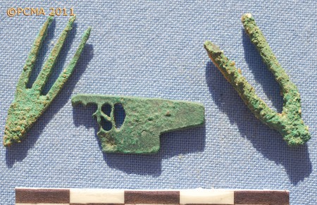
They were found dispersed through all of the loci, several times in groups, but even more interestingly, in the upper layers, the remains included three mummified cat specimens, one perhaps even with an iron collar. Some of these skeletons were covered with potsherds. Were these burials or just dead animals discarded in a part of the rubbish dump? It should be emphasized that adjoining areas explored in previous seasons have not yielded any such remains.
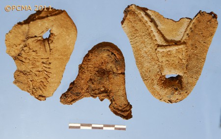
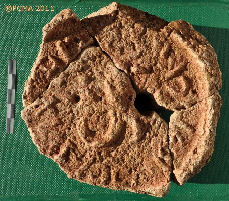
Work in the Ptolemaic industrial district was undertaken on a limited scale and was curtailed when the Wadi Gemal/Sikait project opened. The work was suprvised in the field by architect and surveyor Jean-Louis Rivard (see separate report).
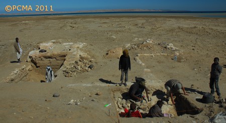
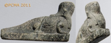
A separate grant helped the Project to launch a documentation study of the Great Temple of Berenike, the so-called Serapis Temple, situated in the eastern part of the site. This work, planned over three to four seasons, is headed by Marteen Hense. Part of the first few weeks was a test trench 2 by 2 m, located against the outside of the west wall of the temple. It is known that this part of the site was occupied in the latest phase, in the 4th and 5th centuries, and that the temple walls have survived practically to the height of the terrace roof. The trench revealed a tumbled wall which should be related to the latest phase, when the temple was filled with sand to the top and walking level could have coincided with the upper parts of the temple walls. A hybrid figurine of the Egyptian god Sobek, carved in stone (BE11-79/004/001), was found in fill among the tumble, dated by the pottery to the later Roman period.
[Text: I. Zych and S. Sidebotham]
For seasons between 1994 and 2001 by the University of Delaware (USA) and Leiden University (the Netherlands), see
http://www.archbase.com/berenike/english1.html

